LEADEX Field Campaign
Ships and submarines have historically used leads, or sea ice fractures, to navigate Arctic waters. Scientists study leads to better understand their roles in arctic climatology and global climate change. Leads, particularly those exposing warm ocean water to cold arctic air, influence the energy balance at polar latitudes by contributing to the atmospheric heat flux. Because the poles act as heat sinks in the global energy balance, lead formation, evolution and distribution in the polar regions is important. The objective of the Arctic Leads ARI was to gain a better understanding of lead dynamics. As part of the project, the Arctic Leads ARI Data Set was created to encourage the assembly of an arctic leads climatology.
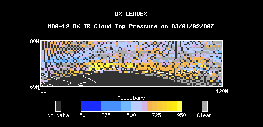
This case study presents data from 1 March 1992 to 30 April 1992 and covers a region from 65N to 80N latitude and from 180W to 120W longitude.
