CASP II Field Campaign
The Canadian Atlantic Storms Program (CASP) II was conducted near the Avalon Peninsula of Newfoundland , Canada, from 15 January through 15 March 1992 to improve understanding and prediction of the mesoscale structure of east coast storms and to improve understanding of the interaction between the atmosphere, ocean and sea ice (Stewart, R.E., 1991: Canadian Atlantic Storms Program: Progress and Plans of the Meteorological Component, Bull. Amer. Meteor. Soc.,72,364-371). Data were collected from aircraft, the local meteorological network, a special "mesonet", and Doppler radar.
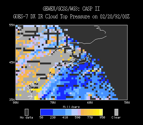
This case study presents data from 26 Feb 1992 to 27 Feb 1992 and covers a region from 35N to 55N latitude and from 80W to 40W longitude.
For more information visit the CASP II Home Page.