GTE/TRACE-A Field Campaign
Large Scale Observations

An aircraft campaign was conducted from 21 September through 24 October 1992 as the NASA Global Tropospheric Experiment - Transport and Atmospheric Chemistry near the Equator-Atlantic (GTE/TRACE-A) to understand processes in the tropical atmosphere controlling atmospheric chemical composition and aerosols, in particular convective transports (see special 30 October 1996 issue of Journal of Geophys ical Research - Atmospheres). Fourteen aircraft flights (NASA DC-8 and Brazilian aircraft, including cooperation with an African experiment conducted by European investigators: Southern African Fire-Atmosphere Research Initiative) covered areas of biomass burning, convective and continental outflow regions, and areas of large-scale subsidence over and between tropical South America and Africa. Aircraft measurements were supported by enhanced surface and upper air meteorological observations, a special ozone-sonde network, and satellite observations. The experimental region extends from 40S-0 latitude and from 40E-70W longitude. (Fishman et al., 1996, JGR 101, 23865-23879; Pickering et al., 1996, JGR 101, 23993-24012; Thompson et al., 1996, JGR 101, 24251-24278).
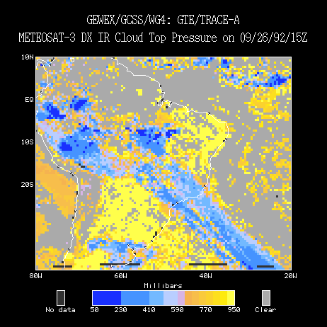
This case study presents data from 21 Sep 1992 to 24 Oct 1992 and covers a region from 40S to 10N latitude and from 80W to 20W longitude.
Gridded Data
TOVS Atmosphere Gridded Data Product

