GPCI Field Campaign
NCEP Weather State Statistical Composites
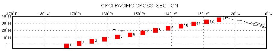
The goal of GEWEX/WGNE Pacific Cross-section Intercomparison (GPCI) is to evaluate climate and weather prediction models in the tropics and sub-tropics, making use of satellite observations. The focus will be on the physics of climate models, including clouds, turbulence, convection and radiation. Models and observations are analyzed along a Pacific Cross-section from the stratocumulus regions off the coast of California, across the shallow cumulus areas, to the deep convection regions of the ITCZ.
This case study presents data from 1 June 2003 to 31 Aug 2003 and covers a region from 5.0S to 45.0N latitude and from 160.0E to 240.0E longitude.
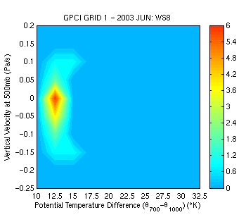
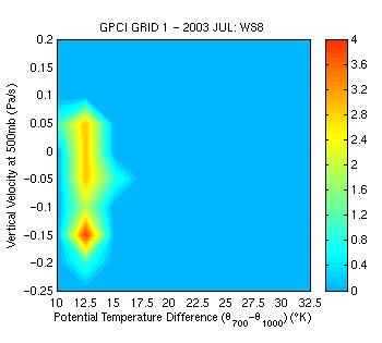
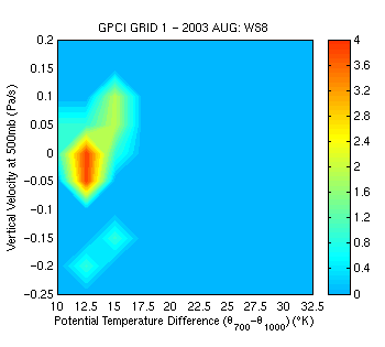
NCEP Weather State Statistical Composites for K=8, Grid 1, for JUNE, JULY AND AUGUST 2003.
 |
 |
 |
|
Presented here are NCEP Weather State Statistical Composites (Vertical Velocity at 500 mb vs. Potential Temperature Difference: 700mb - 1000mb) for each Weather State type along a Pacific cross-section. The diagonal consists of thirteen locations starting at 1S, 173W and moving northeastwards in 4 degree longitude and 3 degree latitude steps to 35N, 125W. To view the weather state histograms of any grid cell, click on that cell in the image below. |
 |
